Before the home computer became a tool to print maps, you had to hand-draw the maps. And even after digital drawing became practical, it was often best to draw the map by hand, bring it home (as there were no computers at ElJAMAR), and then use the software to draw.
The hand-drawn maps show great detail, and show the progression of how runs were added as the years passed.
Here are a number of hand-drawn maps and detailed sections of BBSR in basic chronological order by section. (Some of the maps were drawn and then updated as new runs were added, so this is a bit tricky — see the attached notes for descriptions).
Sled Area Hand-Drawn Maps
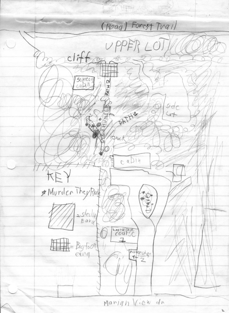
This is one of the earliest full property view maps drawn, likely from around 1986. This only shows Big Thunder and Murder They Rode, what I would call the original two runs that had been sledded since the 1920’s. It does appear there is a Sledding Area listed that implies that other runs exist, but there are no names for them yet. You can also see the Horseshoe Court listed as well as the Side Lot. Only two paths exists at this point, Path 1 and Path 2. Path 2 would later become one of the main sledding runs, Super Colosis.
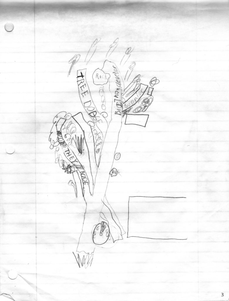
Here’s an early enlargement drawing of the Big Thunder sledding area. You can see Big Thunder and Murder They Rode are well established, but Tree Dodge has been added (later renamed to Dodging Trees). You can also see Surprise (later called Burnout) was added on the upper right, and an unnamed run is drawn between Tree Dodge and Murder They Rode (likely the run now called Double Dare).
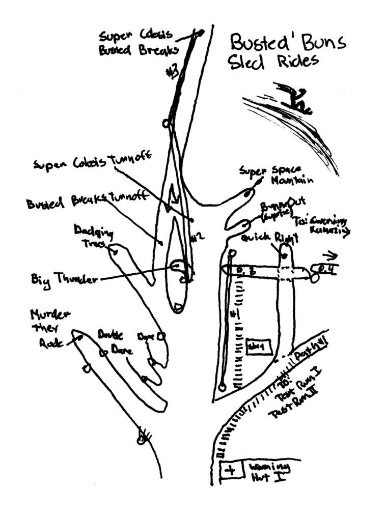
This is one of the early hand-drawn maps, ca. 1986 or 1987. This is pretty much the main runs that had been sledded for years and years before BBSR existed, plus a few new ones (such as Dare & Double Dare, Swerving Kamakazi, Busted’ Breaks and Super Colosis). The big change is Busted’ Breaks turnoff has been added. It also looks like the rope tows have been drawn in pen (likely after the date of this drawing).
Here are two small hand-drawn maps from 1988 or 1989. The one on the left was drawn by Heidi Tweedt.
The odd texture of this map is due to the fact that plastic wrap (yes, the kind you use in the kitchen) was used to cover the map so that a quick-erase maker could be used to label certain runs as temporarily open or closed.
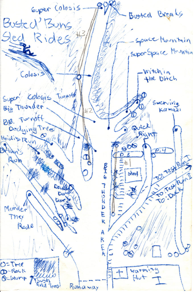
On this small pen-drawn map, there is some good detail. Brian and Heidi’s Run have been added, but not Broken Bottle.
On this map, you can see Broken Bottle,Heidi’s Run, and Brian’s Run being added to this full size map.
In this “Before 2/10/89” Map, you have a lot of the same runs, but with easier to read names by using the boxes. This map was likely started in 1987 or 1988 and added on up to 2//10/89.
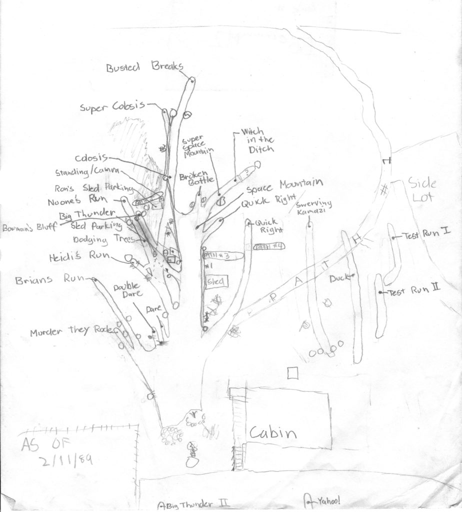
In this map dated 2/11/89, you have a clean drawing of the runs, and room is added on the right to show the Side Lot Sledding area.
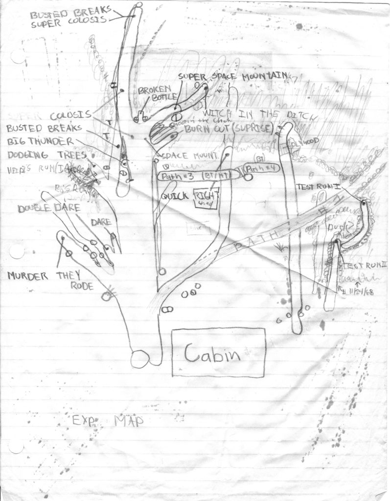
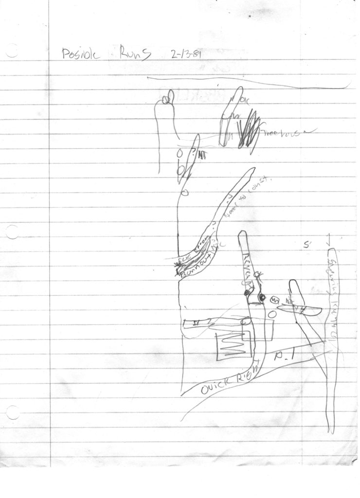
Pardon the spelling, but this map of “Posible” runs from February of 1989 shows the main sledding area (Big Thunder area) with a what would become Maniac at the top right. It also contemplates a “HT” run which was never incorporated. There appear to be some musings of an Eli’s Error and Burnout combo where you would start above these runs and then choose which one to take. I don’t think this ever worked. We can also see the idea for Revenge above Quick Right which seems to say “OK” meaning that it worked and should be added to the printed map.
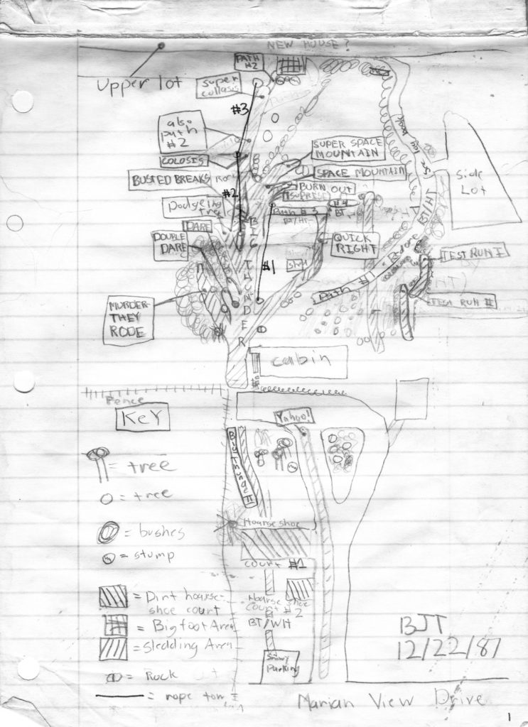
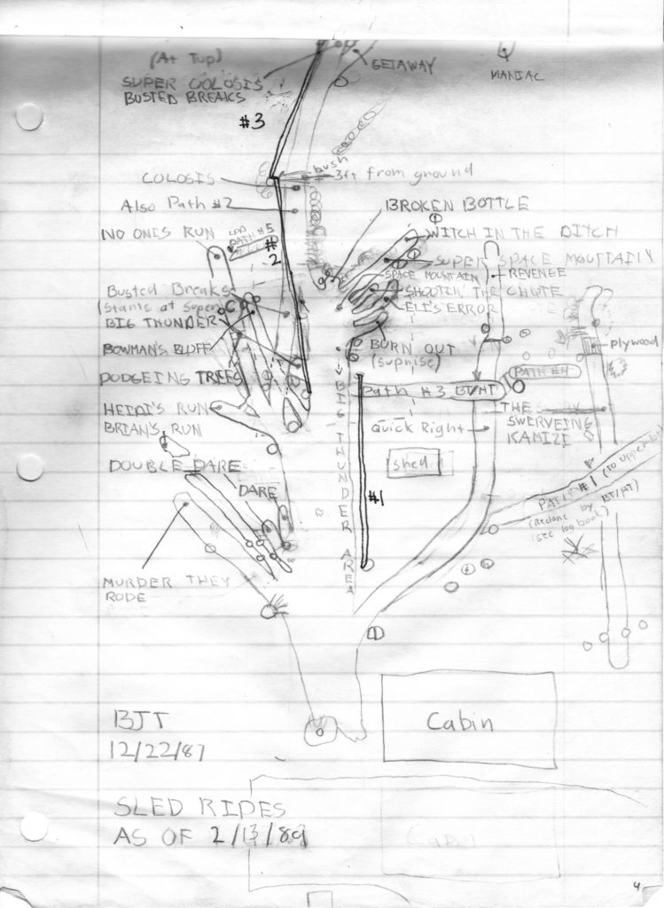
This map was originally drawn 12/22/87 but was updated up to 2/13/89. You can see the addition of Getaway and Maniac near the top of the page. Also, Path 1 was redone by Brian & Heidi.
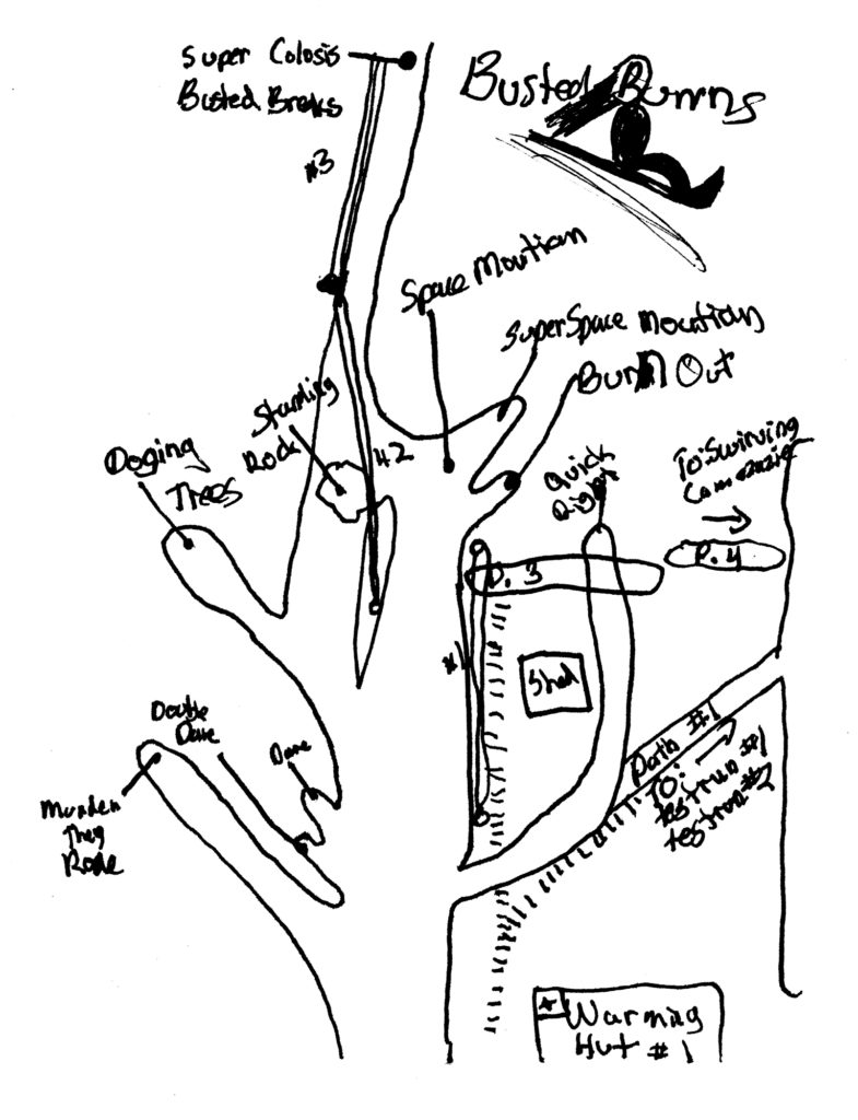
This drawing is an enlargement of the Busted’ Brakes and Super Colosis split. And it includes a great amount of detail of the location of rocks and trees, the specific staring points of the runs that start from the right side of the Big Thunder area, as well as the “Sled Loading” at the beginning and end of the rope tows.
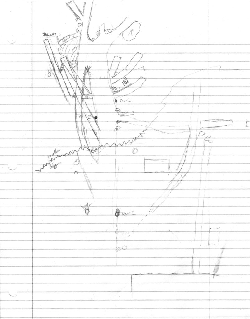
Here is another enlargement likely drawn in the early 1990’s that was used to get better detail on the top part of the Big Thunder area. You can see the addition of Path 5 and much more detail of the (unlabeled) runs in that area. You can see where Falling Rock appears.
“Side Lot Sledding” Hand-Drawn Maps
This drawing from late 1991 or early 1992 shows a more complex and Side Lot Sledding area. It shows the end of Weed Alley (33) at the upper right of the map and The Slickster (40). It proposes three new “Winter Only” runs, Watch Out, Mr. Coyote, and Excalibur. The divide seems to indicate that if there were enough snow, you could build a tunnel and have Watch Out, Mr. Coyote go above The Slickster. To my knowledge, this was never done, but it’s a cool idea.
This very detailed drawing of the Side Lot Sledding area laid out a plan for possible runs and even a new Path 7.
“Upper Runs” Sledding Area Hand-Drawn Maps
After a bulldozer came down from the Upper Lot to service the neighbors’ house, a new path was created that allowed the creation of The Ultimate(6) and The Weaver(7), and brought our attention to the “Upper Runs” area of the hill. You can see the first drawing of Airborne I with the plywood ramp implied. This is the first drawing of Thrill Hill (3), which was named for a large pile of dirt that had collected next to Super Colosis (4). There is no drawing of Five Foot Fallout yet, which would have been just the right of Busted’ Breaks (5).
This drawing is a bit hard to interpret, but in the circled area, you can see the three boards with stakes holding the dirt back for what would become Five Foot Fallout.
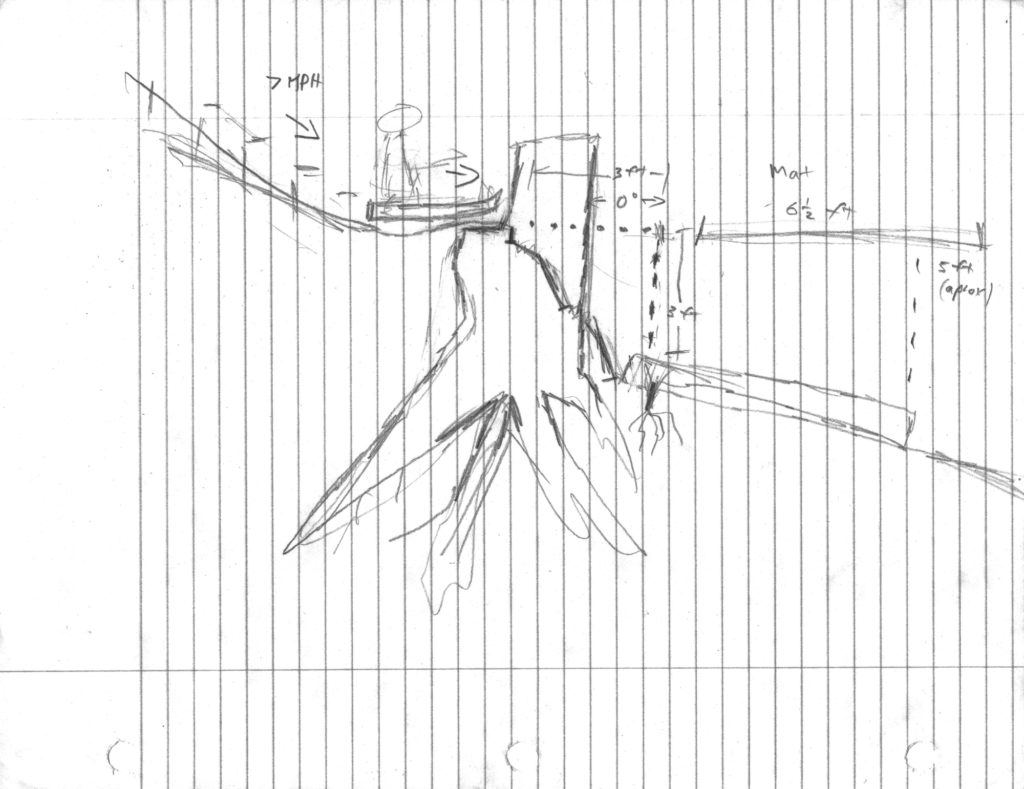
Here is a side-view of Five Foot Fallout and how it would work, and seems to include some semi-scientific measurements. Apparently it’s a minimum 3 foot jump until you hit the mattress (labeled at Mat) which measures 6 1/2 feet long. You will drop 3 to 5 feet, depending on where you land on the mattress, thus the Five Foot Fallout name. ( I guess Three Foot Fallout didn’t have the same ring). Also, you apparently need to be going 7MPH for this to work?